Real estate appraisal report of 20-9 Ekinishi, Murayama-shi, Yamagata-ken 995-0038, Japan
27,700 yen
As the result of the real estate appraisal carried out on Jul 01, 2015, the land value for real estate of 20-9 Ekinishi, Murayama-shi, Yamagata-ken 995-0038, Japan was determined for 27,700 yen / m².
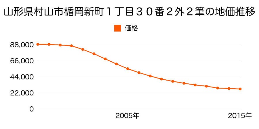
Real estate appraisal report (partly written in Japanese)
| Researched at | 01 Jul, 2015 |
|---|---|
| Lot number(Chiban) | 山形県村山市駅西20番4 |
| Address | 駅西20−9 20-9 Ekinishi, Murayama-shi, Yamagata-ken 995-0038, Japan |
| Price | 27,700yen/㎡ |
| Access | Murayama , 200 M |
| Acreage | 556㎡ |
| Aspect ratio | (1.0:1.5) |
| Structure | 建物などの敷地、W(木造)2F |
| Present | store, residence |
| Water, sewer and gas services | Water, sewer and gas |
| The vicinity | 低層の店舗、店舗併用住宅、医院等が混在する近隣商業地域 |
| Main road | south 22.0m city road |
| The other roads | 東側道 |
| Allocation of use zoning | neighborhood commercial districts |
| Building‐to‐land ratio, Floor area ratio | 80(%),200(%) |
| Development area | city‐planning area |
| Natural environment |
Environment (Written in Japanese)
| 地形・地質 | 扇状地性低地谷の出口など、河川流域の扇状の平地のことである。土地開発は非常に容易であり、造成地の地盤は一般的利用に耐えるものである。 地形性質上洪水や土石流の危険がある地域であり、上流のダム決壊や歴史的豪雨等、数十年から数百年に一度レベルの災害が発生した際には被害地域となる恐れがある。 「国土交通省 地震に対する地盤の安全性 地形分類の評点」:3点(5点満点中) |
|---|---|
| 土地利用・植生 | 宅地 |
| 土壌 | グライ土壌 |
| 黄砂エアロゾル | PM10の飛散は国内においては比較的少ない。PM2.5の飛散については特に少ないというわけでは無いため対策が必要。 |
| 緯度・軽度 | 東経 38度4772999 北緯 140度3840718 |
Map
Kitakata Nagatoro, Higashine-shi, Yamagata-ken 999-3771, Japan4-34 Tateokatōkamachi, Murayama-shi, Yamagata-ken 995-0017, Japan1 Chome Tateokafueda, Murayama-shi, Yamagata-ken 995-0024, Japan1 Chome Chūō, Murayama-shi, Yamagata-ken 995-0035, JapanTateokatawaramachi, Murayama, Yamagata Prefecture 995-0037, JapanTateokafutsukamachi, Murayama, Yamagata Prefecture 995-0015, Japan2 Chome-19-26 Tateokafueda, Murayama-shi, Yamagata-ken 995-0024, Japan1 Chome-6-28 Tateokatsurugachō, Murayama-shi, Yamagata-ken 995-0014, Japan1 Chome-4-31 Chūō, Murayama-shi, Yamagata-ken 995-0035, Japan