Real estate appraisal report of Okaharukita, Asagiri, Kuma District, Kumamoto Prefecture 868-0431, Japan
3,600 yen
As the result of the real estate appraisal carried out on Jul 01, 2015, the land value for real estate of Okaharukita, Asagiri, Kuma District, Kumamoto Prefecture 868-0431, Japan was determined for 3,600 yen / m².
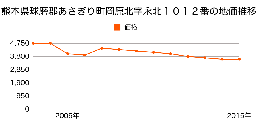
Real estate appraisal report (partly written in Japanese)
| Researched at | 01 Jul, 2015 |
|---|---|
| Lot number(Chiban) | 熊本県球磨郡あさぎり町岡原北字宮野1294番13 |
| Address | Okaharukita, Asagiri, Kuma District, Kumamoto Prefecture 868-0431, Japan |
| Price | 3,600yen/㎡ |
| Access | Higashimenda , 2 , 800 M |
| Acreage | 750㎡ |
| Aspect ratio | (1.0:2.5) |
| Structure | 建物などの敷地、W(木造)1F |
| Present | residence |
| Water, sewer and gas services | Water, sewer and gas |
| The vicinity | 一般住宅、農家住宅、学校等の中に農地が見られる住宅地域 |
| Main road | south west 5.0m city road |
| The other roads | |
| Allocation of use zoning | other areas |
| Building‐to‐land ratio, Floor area ratio | -(%),-(%) |
| Development area | out of city-planning zone |
| Natural environment |
Environment (Written in Japanese)
| 地形・地質 | 砂礫台地砂礫・岩質の土質でできた起伏の少ない地形のことである。土地開発は容易であり、造成地の地質は比較的強固である。 「国土交通省 地震に対する地盤の安全性 地形分類の評点」:3点(5点満点中) |
|---|---|
| 土地利用・植生 | 宅地,水田 |
| 黄砂エアロゾル | PM10及びPM2.5の飛散が国内においては比較的多いため、対策が必要。精密機器の製造などでは品質に問題を及ぼす可能性もある。 |
| 緯度・軽度 | 東経 32度2401883 北緯 130度9325097 |