Real estate appraisal report of Japan, 〒969-6411 Fukushima-ken, Ōnuma-gun, Aizumisato-machi, Tachiishida, Furumiyamae−甲362−1
11,900 yen
As the result of the real estate appraisal carried out on Jul 01, 2005, the land value for real estate of Japan, 〒969-6411 Fukushima-ken, Ōnuma-gun, Aizumisato-machi, Tachiishida, Furumiyamae−甲362−1 was determined for 11,900 yen / m².
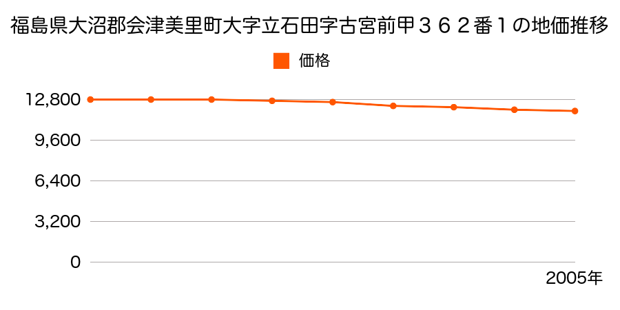
Real estate appraisal report (partly written in Japanese)
| Researched at | 01 Jul, 2005 |
|---|---|
| Lot number(Chiban) | 福島県大沼郡会津美里町大字立石田字古宮前甲362番1 |
| Address | Japan, 〒969-6411 Fukushima-ken, Ōnuma-gun, Aizumisato-machi, Tachiishida, Furumiyamae−甲362−1 |
| Price | 11,900yen/㎡ |
| Access | Niitsuru , Seッ Men |
| Acreage | 331㎡ |
| Aspect ratio | (1.0:2.0) |
| Structure | 建物などの敷地、W(木造)2F |
| Present | store, residence |
| Water, sewer and gas services | Water, sewer and gas |
| The vicinity | |
| Main road | north 10.5m prefectural road府 prefectural road |
| The other roads | 西側道 |
| Allocation of use zoning | other areas |
| Building‐to‐land ratio, Floor area ratio | -(%),-(%) |
| Development area | out of city-planning zone |
| Natural environment |
Environment (Written in Japanese)
| 地形・地質 | 扇状地性低地谷の出口など、河川流域の扇状の平地のことである。土地開発は非常に容易であり、造成地の地盤は一般的利用に耐えるものである。 地形性質上洪水や土石流の危険がある地域であり、上流のダム決壊や歴史的豪雨等、数十年から数百年に一度レベルの災害が発生した際には被害地域となる恐れがある。 「国土交通省 地震に対する地盤の安全性 地形分類の評点」:3点(5点満点中) |
|---|---|
| 土地利用・植生 | 宅地,水田 |
| 黄砂エアロゾル | PM10の飛散は国内においては比較的少ない。PM2.5の飛散については特に少ないというわけでは無いため対策が必要。 |
| 緯度・軽度 | 東経 37度51715859999999 北緯 139度8290272 |
Map
Japan, 〒969-6411 Fukushima-ken, Ōnuma-gun, Aizumisato-machi, Tachiishida, Higashishijūhachi−甲1819−23Japan, 〒969-6405 Fukushima-ken, Ōnuma-gun, Aizumisato-machi, Yoneta, Dōnoatoshita−甲197Japan, 〒969-6411 Fukushima-ken, Ōnuma-gun, Aizumisato-machi, Tachiishida, Furumiyamae−甲362−1Japan, 〒969-6411 Fukushima-ken, Ōnuma-gun, Aizumisato-machi, Tachiishida, Higashishijūhachi−甲1819−23Japan, 〒969-6405 Fukushima-ken, Ōnuma-gun, Aizumisato-machi, Yoneta, Dōnoatoshita−甲197