Real estate appraisal report of Takahashi-52-8 Ōkido, Kunimi-machi, Date-gun, Fukushima-ken 969-1713, Japan
12,700 yen
As the result of the real estate appraisal carried out on Jan 01, 1996, the land value for real estate of Takahashi-52-8 Ōkido, Kunimi-machi, Date-gun, Fukushima-ken 969-1713, Japan was determined for 12,700 yen / m².
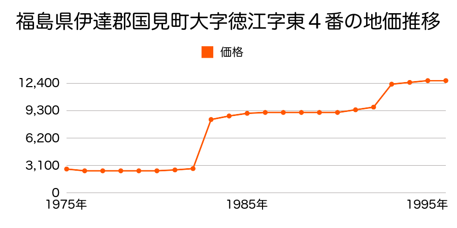
Real estate appraisal report (partly written in Japanese)
| Researched at | 01 Jan, 1996 |
|---|---|
| Lot number(Chiban) | 福島県伊達郡国見町大字大木戸字高橋52番8 |
| Address | Takahashi-52-8 Ōkido, Kunimi-machi, Date-gun, Fukushima-ken 969-1713, Japan |
| Price | 12,700yen/㎡ |
| Access | Fujita , 3 , 400 M |
| Acreage | 382㎡ |
| Aspect ratio | 台形(1.0:1.0) |
| Structure | 建物などの敷地、W(木造)1F |
| Present | residence |
| Water, sewer and gas services | Water, sewer and gas |
| The vicinity | 農家住宅、事業所が見られる県道沿いの住宅地域 |
| Main road | north 7.0m prefectural road |
| The other roads | |
| Allocation of use zoning | other areas |
| Building‐to‐land ratio, Floor area ratio | -(%),-(%) |
| Development area | controlled urbanization area |
| Natural environment |
Environment (Written in Japanese)
| 地形・地質 | 砂礫台地砂礫・岩質の土質でできた起伏の少ない地形のことである。土地開発は容易であり、造成地の地質は比較的強固である。 「国土交通省 地震に対する地盤の安全性 地形分類の評点」:3点(5点満点中) |
|---|---|
| 土地利用・植生 | 水田 |
| 黄砂エアロゾル | PM10の飛散は国内においては比較的少ない。PM2.5の飛散については特に少ないというわけでは無いため対策が必要。 |
| 緯度・軽度 | 東経 37度8749325 北緯 140度5732802 |
Map
Takahashi-52-8 Ōkido, Kunimi-machi, Date-gun, Fukushima-ken 969-1713, JapanTakahashi-52-8 Ōkido, Kunimi-machi, Date-gun, Fukushima-ken 969-1713, Japan