Real estate appraisal report of Nakamaeda Igayachō, Kariya-shi, Aichi-ken 448-0001, Japan
34,000 yen
As the result of the real estate appraisal carried out on Jul 01, 2005, the land value for real estate of Nakamaeda Igayachō, Kariya-shi, Aichi-ken 448-0001, Japan was determined for 34,000 yen / m².
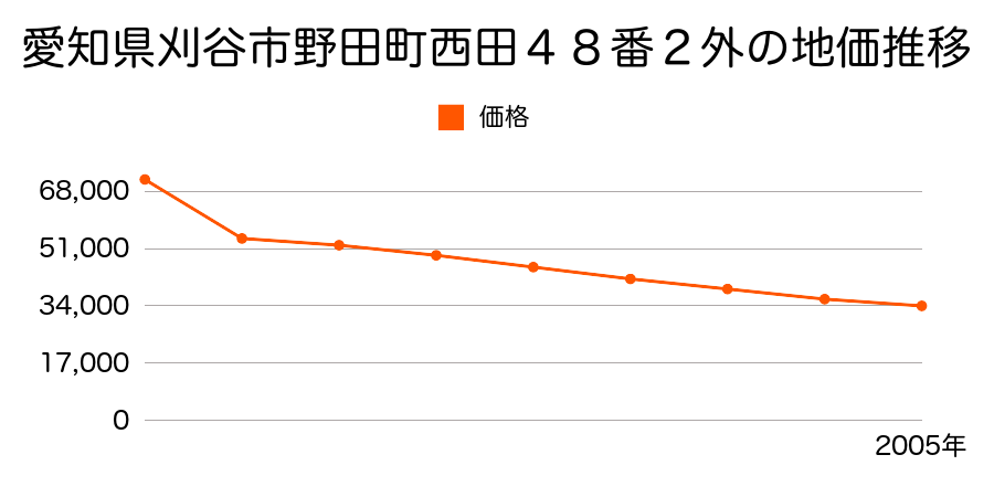
Real estate appraisal report (partly written in Japanese)
| Researched at | 01 Jul, 2005 |
|---|---|
| Lot number(Chiban) | 愛知県刈谷市井ケ谷町中前田22番1 |
| Address | Nakamaeda Igayachō, Kariya-shi, Aichi-ken 448-0001, Japan |
| Price | 34,000yen/㎡ |
| Access | Fujimatsu , 4 , 100 M |
| Acreage | 993㎡ |
| Aspect ratio | 不整形(1.0:1.2) |
| Structure | 畑、その他(SRC,RC,S,W,B以外、及び田、畑) |
| Present | farm |
| Water, sewer and gas services | Water, sewer and gas |
| The vicinity | |
| Main road | 0.0m road unpaved |
| The other roads | |
| Allocation of use zoning | category 1 low rise-rise exclusive residential districts |
| Building‐to‐land ratio, Floor area ratio | 30(%),50(%) |
| Development area | urbanization area |
| Natural environment |
Environment (Written in Japanese)
| 地形・地質 | 砂礫台地砂礫・岩質の土質でできた起伏の少ない地形のことである。土地開発は容易であり、造成地の地質は比較的強固である。 「国土交通省 地震に対する地盤の安全性 地形分類の評点」:3点(5点満点中) 三角州性低地河川の土砂が河口付近に堆積して形成された平野部分であり、長期スパンで見れば洪水の被害に合うリスクの高い地域である。 また、地震に対する地盤の強度も十分ではない。 農業用地として優れているが居住には耐えない。 このような土地を開発してリスクを十分に説明せずに居住用に販売する会社が存在することは嘆かわしいことである。 「国土交通省 地震に対する地盤の安全性 地形分類の評点」:2点(5点満点中) |
|---|---|
| 土地利用・植生 | 宅地 |
| 災害リスク:水害 | 浸水 過去の周辺地域の水害の確認が必要。 |
| 黄砂エアロゾル | PM10の飛散は国内においては比較的少ない。PM2.5の飛散については特に少ないというわけでは無いため対策が必要。 |
| 緯度・軽度 | 東経 35度0547721 北緯 137度0452045 |
Map
Katahira-86-3 Ōshimachō, Toyota-shi, Aichi-ken 473-0935, JapanNishiokacho, Toyota, Aichi Prefecture 473-0936, JapanIppongi-24 Igayachō, Kariya-shi, Aichi-ken 448-0001, JapanUshiroda-50-4 Igayachō, Kariya-shi, Aichi-ken 448-0001, JapanIppongi-24 Igayachō, Kariya-shi, Aichi-ken 448-0001, JapanIppongi-24 Igayachō, Kariya-shi, Aichi-ken 448-0001, Japan